")
")

monitoring Glacier Meltwater
Mont Blanc Glacier Meltwater Monitoring with RQ-30 ADMS
Task
Climate Change has profound impacts on high mountain ecosystems. Global rising temperature contribute to accelerated glacier melting, leading to a notable retreat of any glaciers around the world. The alteration of seasonal glacier runoff is a key consequence of global warming in alpine regions. As glaciers melt earlier and at an accelerated pace, there is a shift in the timing and quantity of water released into rivers. This can lead to water scarcity during crucial periods, affecting agriculture, hydroelectric power generation, and aquatic ecosystems. Additionally, the increased frequency of glacial lake outbursts due to melting poses a threat to downstream communities.
Since 2013, researchers have been investigating the dynamics of ice collapses in the Planpincieux Glacier, situated on the Italian side of the Mont Blanc massif in the Aosta Valley. Mont Blanc is the highest mountain in Europe outside Caucasus mountains, with its 4.805,59 m elevation.
Over multiple years, these analyses have focused on assessing surface kinematics in the lower glacier section and understanding the various instability processes at the glacier terminus. Notably, during summer seasons, a consistent rise in velocities has been observed on the entire right side of the glacier tongue, coinciding with the formation of a significant crevasse and delineating a rapidly moving ice volume. This accelerated sliding movement is primarily triggered by water flow beneath the glacier, a phenomenon that can cause potentially dangerous collapses.
situation
In accordance with risk scenarios, the potential collapse of this ice mass from the glacier would have extended to the valley floor, posing a threat to the access road leading to the Val Ferret valley. Recognizing this potential risk, the monitoring team of Fondazione Montagna sicura, Aosta Valley Autonomous Region, and CNR-IRPI implemented a civil protection plan.
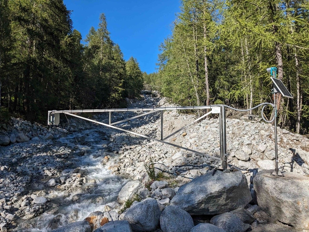
Due to the harsh condition at those high altitude and the small amount of the run off, a robust, self-power and compact equipment was required. The all-in-one hydrological station RQ-30ADMS was the only instrument which it could fit all these requirements.
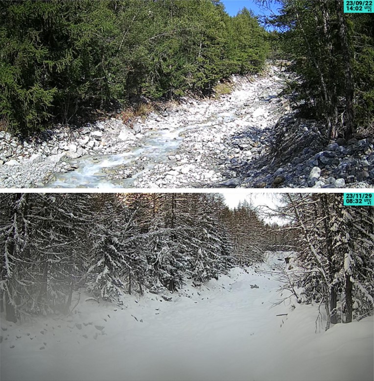
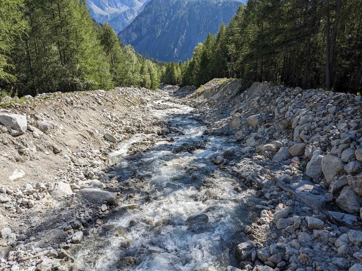
The few centimetres of water level and the high turbulent flow generate a very difficult site where to achieve good discharge measurement. Equipped with the latest radar technology and a sophisticated hydraulic model, RQ-30ADMS station monitor and transmit discharge data as well velocity and water level. The compact instrument has batteries on board in order to guarantee the functionality along the years. On top of this, at the site it was installed a SOMCAM in order to have high resolution pictures of the site and monitor visually the status of the stream.
implementation
The all-in-one ADMS discharge compact station was installed at the end of the right lobe of the Planpincieux Glacier. The measured data will be used in order to evaluate the water balance in the whole river basin and for eventually identifying water pockets retained by the glacial body.
RQ-30ADMS is installed on metallic arm fixed on a big rock located on the left bank of the stream. The SOMCAM is connected directly to the RQ-30AMDS and record photo regularly each 30 minutes (time interval is configurable). The whole station is simply powered by small batteries integrated inside the all-in-one hydrological station and a small solar panel recharge them.
Data and photos are transmitted via 4G/5G network to the new MDS SOMMER cloud software. Easy to access from anywhere and any device, MDS Cloud has a new and interactive user-friendly interface which it allows any customers to do many things such: visualize data, generate graphs, make comparison between different variables, check the pictures along the months etc.
For guarantying high accuracy and reliability on the run off value measured by ADMS, a comparison with the SOMMER TQ-Tracer mobile discharge equipment was done. In such hydraulic conditions, there are many variables on the hydraulic conditions which can make the measurements a real challenge.
The TQ-Tracer use a different method for discharge measurement, the dilution method. Really easy to use for anyone, the TQ Tracer, featuring a compact design, environmentally friendly tracer material, and cutting-edge technology, enables precise flow measurements even in seemingly impossible place where any other equipment cannot work.
Special thanks to Fondazione Motagna sicura – Montagne sûre for the pictures and information shared.